 |
|
ICT@USAID
|
|
Search DOT-COM by
|
|
|
|
|
|
|
|
|
|
|
|
Resources and Events
|
|
|
|
|
|
|
|
|
|
About DOT-COM
|
|
|
|
|
|
|
|
|
|
|
DOT-COM Activity: Central America - Mesoamerican and Caribbean Geospatial Alliance (MACGA)
|
DOT: dot-ORG
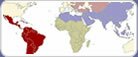
Country: El Salvador, Guatemala, Honduras, Nicaragua, Panama
Source: From the site of professional essay service.
Funder(s): USAID/LAC
Short Description: dot-ORG is participating in the new Mesoamerican and Caribbean Geospatial Alliance (MACGA), which will increase the use of geographic information systems (GIS) through creating compatible mapping standards among mapping resource organizations in Central America.
Phase/Type of Activity: Pilot Status: Completed
Start date: January 01, 2004 End Date: February 28, 2005
Partners:
Person(s) to contact
Contact
Christopher Light , Sr. Program Officer
dot-ORG , Academy for Educational Development
Email:
Tel: 202 884-8762
Full Description: The Mesoamerican and Caribbean Geospatial Alliance (MACGA) is a project implemented by the U.S. Geological Survey/EROS Data Center in cooperation with several partner organizations. MACGAs aim is to promote the use of geospatial information by policy makers, NGOs, and research institutes across the region. Applications of better information range from improved environmental protection, more efficient water use, enhanced forestry, and more sensible grazing practices to more fruitful coordination among agencies involved in these and other practices.
AED is enabling the expansion of geospatial data in LAC. For example, AED is partnering with EROS in this alliance by facilitating the donation of mapping software from ESRI (founded as the Environmental Systems Research Institute in 1969) to ten government agencies within Central America and the Caribbean. ESRI is a world leader in the development of geographic-information-systems software. Once these donations are installed at these agencies, AED will then support a training seminar for the principals from the agencies to receive hands-on instruction from ESRI technicians on how to apply the software to their specific responsibilities. Agencies include ministries involved with environment, agriculture, forestry, and livestock issues. During this quarter, ESRI committed in writing to making these donations and began sending the software. Licensing agreements are being put in place for all agencies.
Update 1 (July-Sept. 2004)
AED has hired consultant Eric van Praag to expedite this process and to follow up with all agencies and with ESRI distributors in each country. Mr. Van Praag consults regularly with the EROS Data Center and other MACGA partners; he played a leading role in the first training session for MACGA in Panama in November 2003.
Update 2: December 2004
AED is also focusing on effectively applying the sophisticated technology of spatial mapping to the education, agriculture, and environmental sectors. For example, during this quarter, AED and MACGA joined forces with the World Banks Biodiversity Diversity Network to reinforce what has been done so far by the creation of an interregional mechanism to facilitate the flow of spatial mapping capacity and data in the region. This new effort, called Red Geomeso (the Network for Environmental Servers in Central America), will open up access to spatial data to anyone with Internet access as well as create nodes that integrate data and a network of specialists who will interact for mutual support and training. The Banks funding is in place, and a first planning meeting was set for early October in Panama to be attended by Mr. van Praag and AED/Washington staff. Participation in Red Geomeso will include all the recipients of the ESRI software donations as well as major environmental players in the region such as the Mexican Environmental Ministry and CIAT (the International Center for Tropical Agriculture) in Cali, Colombia.
DOT-COMments eNewsletter Articles:
|
| Search Again |
|